Activity
What people are figuring out about these photos — answers, comments, and the cases we've cracked.
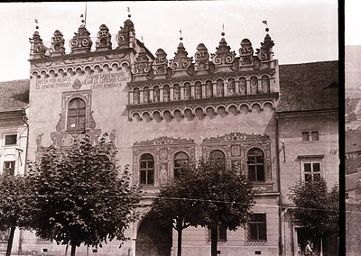 Historic Baroque-style building with ornate stonework, featuring intricate carvings, arched windows,...
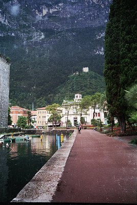 Lakefront promenade flanked by historic lakeside buildings in a European alpine town. Stone-paved wa...
- One decade - 1990s
- Decade range - 1990s-1990s
- Exact spot - 45.8846153, 10.8420186, 62°
- Place - Riva del Garda
- Country - Italy
- Decade range - 1990s-1990s
- One decade - 1990s
- Exact spot - 45.8846153, 10.8420186, 62°
- Place - Riva del Garda
- Country - Italy
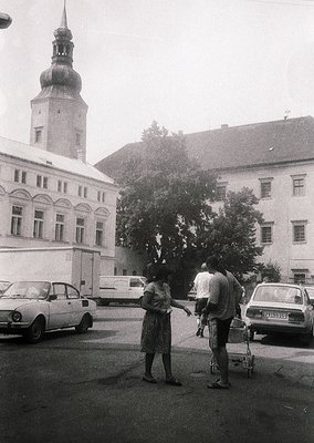 1960s-era street scene in a European town square with classic architecture: a woman in a knee-length...
- Year/date range - 1991-1994
- One decade - 1990s
- Decade range - 1980s-1990s
- Exact spot - 49.5496380, 17.7349870, 341°
- Place - Hranice
- Country - Czhechoslovakia
- Year/date range - 1991-1994
- One decade - 1990s
- Decade range - 1980s-1990s
- Exact spot - 49.5496380, 17.7349870, 341°
- Place - Hranice
- Country - Czhechoslovakia
- Other pictures from the film are also from Hranice, both the shopping row under arches in Zamecka street and "SECOOP – KANCELÁŘSKÁ TECHNIKA" shop in a row of houses. That shop actually pointed to Hranice being the correct location.
- This is Přerov district (okres), 1960–2001 system. PR = Přerov (North Moravia). White background with black text = passenger car. The "E" is likely an additional series letter — as the original 4-digit number space (PR 00-01 through PR 99-99) filled up, districts were allocated extended series. So the full reading would be PR-E 90-25, meaning Přerov, series E. That said, if this is from a degraded negative and the "E" is uncertain, it's worth noting that PR as a two-letter code points unambiguously to Přerov regardless — no other district shared that prefix in the 1960–2001 system.
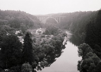 Vintage black-and-white aerial view of a grand arched viaduct spanning a river, flanked by dense for...
- Decade range - 1960s-1980s
- Exact spot - 49.2952156, 14.4709267, 80°
- Place - Bechyně
- Country - Czechoslovakia
- Decade range - 1960s-1980s
- Exact spot - 49.2952156, 14.4709267, 80°
- Place - Bechyně
- Country - Czechoslovakia
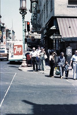 Vintage street scene at Washington Ave intersection, likely San Francisco’s Chinatown. Crowd of 1970...
- Year/date range - 1970-1977
- One decade - 1970s
- Year/date range - 1970-1977
- One decade - 1970s
- Decade range - 1970s-1980s
- Exact spot - 37.7951650, -122.4064480, 349°
- Place - San Francisco
- Country - USA
- Decade range - 1970s-1980s
- Exact spot - 37.7951650, -122.4064480, 349°
- Place - San Francisco
- Country - USA
- This is the intersection of Washington St and Grant Av in San Francisco's Chinatown. 37° 47' 42.80" N by 122° 24' 23.18" W. A very popular tourist destination.
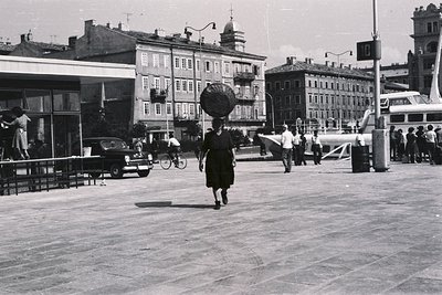 A woman carries a basket on her head, traversing a paved plaza. Buildings with tiered facades rise i...
- Decade range - 1960s-1960s
- Exact spot - 45.3256644, 14.4405133, 90°
- Place - Rijeka
- Country - Croatia
- Exact spot - 45.3256644, 14.4405133, 90°
- Decade range - 1960s-1960s
- Place - Rijeka
- Country - Croatia
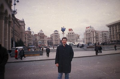 A man stands on a wide, expansive plaza with a monumental sculpture visible in the distance. Buildin...
- Maidan Nezalezhnosti (Independence Square) in Kyiv, Ukraine.
- One decade - 2000s
- Decade range - 1990s-2000s
- Exact spot - 50.4496690, 30.5239790, 321°
- Place - Kiev
- Country - Ukraine
- One decade - 2000s
- Decade range - 1990s-2000s
- Exact spot - 50.4496690, 30.5239790, 321°
- Place - Kiev
- Country - Ukraine
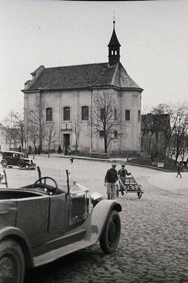 A stately building, possibly a church or public hall, dominates the view, its facade symmetrical wit...
- Church of the Holy Trinity, Hlohovice, Czech Republic
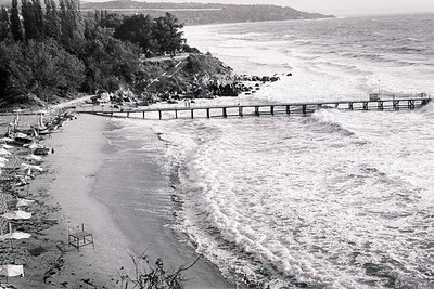 Dramatic waves crash along a pier extending into the Black Sea. A sandy beach lined with umbrellas a...
- Varna Beach
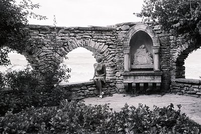 Woman sits thoughtfully within a stone courtyard, framed by arched stonework and a niche containing ...
- Hammond Castle Museum, Gloucester, Massachusetts
- google.com/maps/place/Balchik+Botanic+Garden/@43.403457,28.147472,3a,75y,42.72h,58.47t/data=!3m8!1e1!3m6!1sCIHM0ogKEICAgIDZpPn-7AE!2e10!3e11!6shttps:%2F%2Flh3.googleusercontent.com%2Fgpms-cs-s%2FABJJf53bJbQ5dxQGB4-mEhEpuG7ujMAZxxFa1l7lK2reJNN6d0CV1149KKEVoUzzsIUstGOUnH6-Tbw_oZoJIApjAFw5wTHVmzv3PdRJrd5aEZIMD0fWCOX6z44SqbFoa7M8uk6vSOa0Bg%3Dw900-h600-k-no-pi31.534423768000472-ya42.72274974362803-ro0-fo100!7i5760!8i2880!4m6!3m5!1s0x40a4e364109fc3e7:0x515066ea4d2ce54!8m2!3d43.4038717!4d28.1481797!16s%2Fg%2F1236mld4?hl=en&entry=ttu&g_ep=EgoyMDI2MDYyMy4wIKXMDSoASAFQAw%3D%3D Bulgaria, Balchik botanical garden
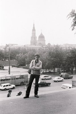 A man with short hair stands arms crossed, facing the camera, with a tall church dome visible in the...
- Annunciation Cathedral, Kharkiv
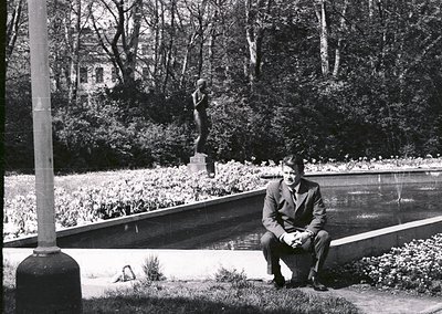 Mid-20th century man in formal attire sits by a reflective water feature in a landscaped park. Class...
- Exact spot - 50.0964559, 14.4302039, 75°
- Decade range - 1970s-1970s
- One decade - 1970s
- Exact spot - 50.0964559, 14.4302039, 75°
- One decade - 1970s
- Decade range - 1970s-1970s
- Place - Prague
- Country - Czechoslovakia
- Decade range - 1930s-2000s
- Place - Prague
- Country - Czechoslovakia
- mapy.com It seems that it's not there anymore (edited)
- ◎ #57 I think it's this one: umenipromesto.eu
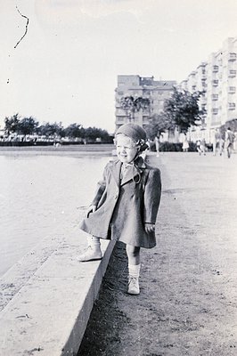 Young girl in a wool coat and matching hat stands playfully near a low wall, overlooking a seaside p...
- One decade - 1940s
- Decade range - 1940s-1940s
- Exact spot - 47.5186330, 19.0506590, 32°
- Place - Budapest
- Country - Hungary
- Decade range - 1940s-1940s
- One decade - 1940s
- Exact spot - 47.5186330, 19.0506590, 32°
- Place - Budapest
- Country - Hungary
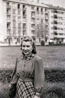 Young woman in 1950s-era clothing poses outdoors near Soviet-style apartment blocks. She wears a but...
- One decade - 1940s
- Decade range - 1940s-1940s
- Exact spot - 47.5162265, 19.0604629, 322°
- Place - Budapest
- Country - Hungary
- wow!
- Decade range - 1940s-1940s
- One decade - 1940s
- Exact spot - 47.5162265, 19.0604629, 322°
- Place - Budapest
- Country - Hungary
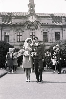 A formally-dressed couple, bride in a short veil and suit, groom in military uniform, pose for a pho...
- One decade - 1960s
- Decade range - 1960s-1960s
- Exact spot - 50.1077418, 14.4719669, 255°
- Place - Prague
- Country - Czechoslovakia
- Nice, close to my home :) Now I realize where the place is.
- One decade - 1960s
- Decade range - 1960s-1960s
- Exact spot - 50.1077418, 14.4719669, 255°
- Place - Prague
- Country - Czechoslovakia
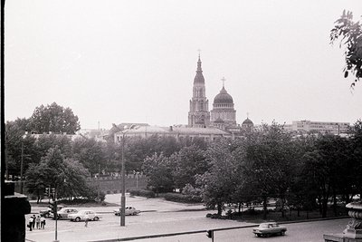 Overlooking a plaza, a monumental cathedral dominates the skyline. Classicist architecture with a ce...
- ZAZ-968A. It was manufactured from 1970s to 1979s.
- Ukraine. Kharkiv. Blagoveshchensky Cathedral.
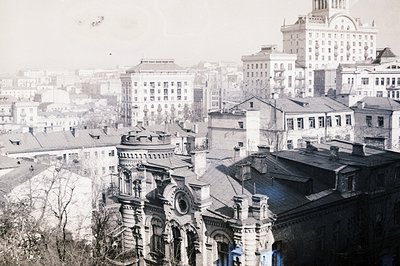 A high-angle, grayscale view of a European cityscape featuring ornate, multi-story buildings with de...
- Decade range - 1960s-1970s
- Exact spot - 50.4425135, 30.5249721, 299°
- Place - Kiev
- Country - USSR
- Decade range - 1960s-1970s
- Exact spot - 50.4425135, 30.5249721, 299°
- Place - Kiev
- Country - USSR
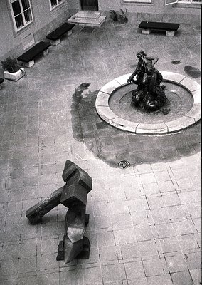 Aerial view of a courtyard featuring a classical fountain with a seated female figure holding a bowl...
- Year/date - 1994
- Year/date range - 1994-1994
- One decade - 1990s
- Decade range - 1990s-1990s
- Exact spot - 48.1447925, 17.1075557
- Place - Bratislava
- Country - Slovakia
- muzeum.artgallery.sk 1994, Bilancia, GMB, Bratislava, Slovenská republika en.wikipedia.org The Bratislava City Gallery (Slovak: Galéria mesta Bratislava, abbr. GMB) is a gallery located in Bratislava, Slovakia, in the Old Town. It is the second largest Slovak gallery of its kind.[1] The gallery is housed at the Mirbach Palace (Mirbachov palác) So the sculptor had a personal exhibit in the palace in 1994. Also other pictures from the same film have 1990s cars in them and one with "SK" international sticker, meaning this is after split of Slovakia in 1993 (edited)
- sculpture by Juraj Meliš
- ◎ #61 i0.wp.com
- Year/date range - 1994-1994
- Year/date - 1994
- Decade range - 1990s-1990s
- One decade - 1990s
- Exact spot - 48.1447925, 17.1075557
- Place - Bratislava
- Country - Slovakia
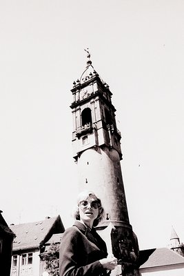 Tall, monumental clock tower dominates this image, rising above a woman in a dark suit and spectacle...
- The Reichenturm, known in Upper Sorbian as Bohata wěža, is a tower that was part of the former city fortifications of Bautzen (Germany). It is located on the eastern edge of the Old Town, marks the end of Reichenstraße, and stands on Kornmarkt, across from the Liebfrauenkirche.
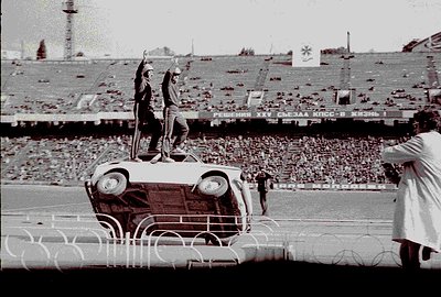 A man stands atop a vintage Volga sedan at a stadium, raising his arm in a gesture that could be int...
- Exact spot - 50.4332439, 30.5223627
- Year/date range - 1976-1980
- Decade range - 1970s-1980s
- Place - Kyiv
- Country - Ukraine
- Year/date range - 1976-1980
- Decade range - 1970s-1980s
- Exact spot - 50.4332439, 30.5223627
- Place - Ukraine
- Place - Kyiv
- Country - Ukraine
- maps.app.goo.gl (edited)
view photo →